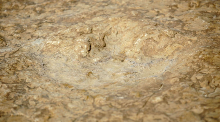
Australia's 'Jurassic Park' yields giant dinosaur footprints

The world’s most varied collection of dinosaur tracks was recently found in northwestern Australia. Among the biggest dinosaur footprints tracked belonged to the long-necked herbivore – a sauropod.
It measures close to 5 feet 9 inches (1.75 metres), Steve Salisbury, lead author of the study and a University of Queensland senior lecturer, told CNN. The record-setting fossil footprints were found in a rocky coast of Western Australia.
Salisbury’s team has been conducting over five years of work in the area he has referred to as Australia’s “Jurassic Park.” A total of 21 different dinosaur tracks were uncovered across the Dampier Peninsula.
The palaeontologist noted that the conditions on the Dampier Peninsula were ideal for the creation of the tracks as well as their preservation. He described the recent find as quite “spectacular” and referred to the dinosaur track fauna of Walmadany (James Price Point) as the most diverse in the world.
“Dinosaur tracks of the Broome Sandstone fill a huge gap in our knowledge of Australia's Cretaceous dinosaur faunas,” Professor Salisbury tweeted. In a paper published in the Journal of Vertebrate Paleontology, Salisbury and his colleagues spent over 400 hours of ichnological survey work from 2011 to 2016 on the 25km stretch of coastline in the Yanijarri–Lurujarri section of the Dampier Peninsula.
Sailsbury says that the tracks include the only confirmed evidence of Australian stegosaurs as well as some of the largest dinosaur tracks ever recorded. The footprints of a long-necked sauropod are nearly six-foot-long each.
The dinosaur tracks are but one of a series of amazing finds in the area. The palaeontologists also found some rocks dating back to 140 million years. The team of researchers responded to a request from members of the indigenous group Goolarabooloo that serves as the area’s traditional custodian.
Goolarabooloo Law Boss Phillip Roe wanted the world to see what was at stake if plans for a planned natural gas plant would push through. A cultural history was at stake. Over 120 million years ago, the fossil tracks were formed in mud, now solid sandstone.
Mapping the coastal footprints meant keeping environmental considerations in mind. The University of Queensland palaeontologists that include Anthony Romilio developed high-tech methods including digital maps. Remote sensing has certainly revolutionised dinosaur research, allowing tracks to be mapped from the air.
Using 3D modelling of track sites, the research was able to confirm what kind of dinosaur it was, if it was moving in a certain way, or if it was really a dinosaur track. The team used a combination of high-resolution aerial photography and lidar (a detection system that uses light from laser), drone and light aircraft.


